
Looking Up Your Lehigh County Neighbors
A block search is a parcel-context exercise, not a resident roster. The County's mapped parcel and assessment tools identify specific land records, while voter and civic sources have their own narrow rules. Start from one confirmed address, record the source and date, and ask what each result actually shows. A nearby owner, a mailing line, and a historical occupant are separate facts that should never be merged into an assumption about who currently lives there.
| Source | What It Shows About a Block | Access |
|---|---|---|
| County Parcel Viewer | Parcel geometry, site line, PIN, land use, assessment context, and map links for a specific area | Public reference viewer, not a surveyed boundary source |
| PropertySearch | Assessment owner and parcel or document lead for a selected address or PIN | Public search with captcha and input limits |
| Pennsylvania voter channels | Individual status, or defined Street and Walking List products under election rules | Not open neighborhood browsing |
| Allentown neighborhood groups | City-described civic areas, group status, meetings, and contacts | City information, not membership proof |
| Local history collections | Dated directory, map, newspaper, church, cemetery, or yearbook context | Repository and item-specific access |
County GIS includes parcel, site, and assessment fields, including owner and mail-line data. It does not identify all residents. A separate mailing address can be an assessed owner's correspondence line, not the situs and not a list of occupants. Treat other household members, visitors, delivery, utility, and protected-address information as outside this public parcel workflow.
Map Lehigh County Neighbors
The County Parcel Viewer accepts an address or place, a PIN Search, or an Assessment Address search. Suggestions and results for the PIN and assessment-address tools are capped at six, so a broad entry may need a more complete address. Red centroids open assessment information, and the More Info control is the route to the current source context. Parcel lines are reference-only, which matters when a block question starts to look like a boundary dispute.
- Current address: enter the complete, known address and compare the returned site line with the mapped municipality and mailing-style city or ZIP.
- PIN or PAR: record the 12-digit PIN and, where shown, the one-to-five-digit PARNUM. These are the durable identifiers for the next search.
- Parcel Viewer: reopen the address or PIN, click the relevant red centroid, and use More Info to separate the parcel result from any mail line.
- Adjacent parcels: inspect adjoining polygons or a documented buffer, saving each parcel ID and site line with the query date rather than compiling people.
For a complete named-street trail rather than the immediate block, use the Lehigh County street directory. The street workflow keeps the broader address chain separate from a few nearby parcels.
Lehigh County Neighbor Parcel Context
The viewer's Buffer Report can run from an Address or PIN result or a drawn feature. Its default distance is 100 feet and its output is capped at 1,000 features. The map also supports land-use selection and a subdivision field. Visible context can include site address, parcel ID, class, sale and assessment values, zoning, subdivision, and neighborhood. Those fields support a repeatable parcel inventory, not a claim about the people on a block.
Record the buffer distance, date, viewer URL, candidate parcel IDs, and the map disclaimer. Use parcel geometry only as a reference. It cannot settle title, a surveyed boundary, a relationship between owners, or the current number of residents. A missing feature is also not proof that no related record exists elsewhere.
Note: A map label and an assessment field are source-specific facts, so retain them without expanding their meaning.
Lehigh County Neighbor PINs
Lehigh County's parcel guidance defines the PIN as 12 digits and PARNUM as one to five digits. A PIN and PAR may be separated by a space or dash. Use both when a parcel record supplies them, especially before comparing lots that share a street name or a subdivision label. The identifiers reduce the risk of connecting a current map feature to the wrong nearby address.
Old map, block, and lot wording still belongs in historical notes, but County guidance says it is no replacement for PIN or PAR. Keep historic wording beside the map edition and directory year. A present parcel should not be matched to an earlier lot merely because the label looks familiar. Mailing-city differences add another local caution: an Allentown postal label can occur with a different mapped municipality.
Lehigh County Neighbor Parcel Records
Once the viewer identifies a parcel, PropertySearch can be used for the address, PIN, or Document ID or Instrument Number. It has no open owner-name or ZIP selector. The screen requires four characters or more, a selected type, and a captcha. Its result is a parcel or document lead, not confirmation that an assessed owner lives at the site or that another person nearby is a neighbor.
When a record provides a document number, transfer that number to the Recorder route and inspect the actual instrument for its date, party roles, and legal description. Do not convert a sales field or an assessment value into a title conclusion. Each nearby parcel has its own record trail, and a relationship between adjacent owners cannot be assumed from the map.
Lehigh County Neighbor Voter Limits
The voter-status form uses first name, last name, date of birth, county, and ZIP to check an individual registration. That makes it a personal identity-status route, not a way to browse everyone on a Lehigh County block. The local Voter Registration Office and state hotline are the documented alternatives when a registrant needs help with their own record.
Pennsylvania does recognize separate Public Information, Street, Walking, and Full Voter Export products. They are signed, regulated requests. A Street List contains name, residential address, mailing address, party, and active or inactive status, while a Walking List omits the mailing address. The form requires identification, a selected county and list type, and an affirmation restricting use and forbidding internet publication. These products do not create an open neighborhood directory.
Compare Lehigh County Neighbor Records
Official parcel records and commercial neighbor-search categories serve different purposes. The first have a named custodian, defined fields, and a specific retrieval date. The second can combine data from unclear sources, use stale address associations, or omit the record boundaries that explain what a result means. Neither category proves a complete current household.
| Official county or state record | Can identify the custodian, source field, date, parcel or docket identifier, and access restriction. |
|---|---|
| Commercial neighbor-search category | May summarize address associations, but its update method, coverage, and identity matching should not replace the original record. |
| Responsible conclusion | State only the fact the underlying record supports, then stop if identity, residence, or protection status is uncertain. |
Lehigh County Neighbor Civic Groups
For addresses inside Allentown, the City-published neighborhood-groups information provides a civic layer. It lists groups with stated areas or boundaries, activity status, meetings, and contact information. It can help explain a community reference or point to a current civic contact, but it does not establish a formal county border, an address's membership, or a roster of residents.
| City-listed group | City-described context | Responsible use |
|---|---|---|
| 8th Ward Group | N. 7th through N. 12th Streets, from Sumner to Liberty, in the October 2024 City list | Record the document date and described area; do not infer membership |
| Community Block Ambassadors | City-described area north of Hamilton and south of Gordon, extending east from Jordan Creek toward the Lehigh River | Use as civic context only, then recheck current City information |
The City’s Allentown Neighborhood Groups page is the source represented below.
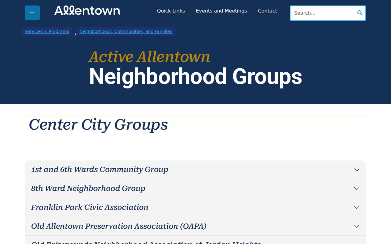
Use a group entry to understand City-described civic context, then confirm current activity or contact details directly with the City rather than relying on an older list.
Lehigh County Neighbor History
The Lower Macungie Library Local History and Genealogy Center holds church and cemetery records, school yearbooks, and local-interest material for Lower Macungie, Macungie, Allentown, Bethlehem, Easton, Lehigh County, and nearby counties. Its Pennsylvania Railroad, Air Products, Bethlehem Steel, and Mack Trucks subjects can help choose historical material for a period or locality.
That collection is historical community context, not a current neighbor list. Pair any directory, yearbook, cemetery, or newspaper entry with its exact year, page, reel, or collection identifier. A historic address or group reference should never be carried forward as an unverified present-day connection.
Lehigh County Neighbor Privacy
A County parcel record is not a household list. It may display an assessment owner and mailing fields, but it does not establish occupants, private contact information, family relationships, or a person's right to be located. Sealed, redacted, and unavailable material stays outside the block search. A request under the Pennsylvania Right-to-Know Law can be answered with lawful redactions and should identify a record, not seek an address trail around a protected person.
Pennsylvania's Address Confidentiality Program permits eligible participants to use a substitute address in listed government records. An absence, substitute address, or mismatch can be a safety measure. It must not be treated as a gap to overcome through parcel, voter, civic, or historical sources.
Lawful use. Use Lehigh County neighbor records for lawful personal context only. Do not use an address, parcel, or civic record to stalk, harass, intimidate, or expose a protected person.