
Lehigh County Previous Residents Sources
Past residents require different sources for different eras. The county Recorder trail begins in 1812. Its Russell Index covers 1812 through 1983, while the county describes LANDEX records from 1812 to present. APL directories, LCHS maps, and a dated newspaper issue can add an address or household clue, but they do not replace the recorded instrument. Start with the era that has the best local source, then carry its date, exact place wording, and citation into the next source.
| Source | Years It Covers | Where Held | What It Shows |
|---|---|---|---|
| Recorder records and LANDEX | 1812 to present | Recorder of Deeds and county ORA channels | Recorded-document and title-trail evidence |
| Russell Index | 1812 to 1983 | County ORA subscription and recorder route | Historic deed-index bridge |
| LCHS 1816 survey, 1862 map, and 1876 atlas | 1816, 1862, and 1876 | Lehigh County Historical Society | Dated property-holder and place context |
| LCHS Sanborn maps | 1885 to 1927 | Lehigh County Historical Society | Town-specific building and street context |
| Allentown city directories | 1860 to 1980 | Allentown Public Library | Dated address and household clues |
| Morning Call and obituary index | 1895 to present; index 1895 to 1983 | Allentown Public Library | Newspaper retrieval date and page |
For later recordings, the county reports books through April 19, 2002 and computer images beginning April 22, 2002. The cutoff indicates the likely retrieval medium. It does not create a gap in the Recorder’s stated 1812 to present record trail.
Read the table as an access timeline, not as one merged account. A directory gives a printed clue for its own year, a map records a particular edition, and a deed ties parties to a recorded transfer. When the dates disagree, keep the conflict visible and return to the custodian that holds the underlying item.
Lehigh County Previous Residents Before 1812
Lehigh County’s Recorder history starts in 1812. For an older land question, treat that year as a custody checkpoint rather than forcing an earlier reference into a modern county index. LCHS has federal census microfilm for Lehigh and Northampton from 1790 through 1930, as well as regional and county historical material. Its original 1816 county survey is indexed by property holder and can add dated location context once a surname or legal-description clue exists.
A survey label is not a continuous title chain. The research did not locate a source-by-source official custody map for every pre-1812 predecessor record, so record the repository and date before asserting an earlier connection. This is a case where uncertainty is more useful than a false match.
Note: An 1816 property-holder label is a dated map fact, not proof that the same title continued afterward.
Lehigh County Previous Residents Deed Chain
The backwards deed chain starts with a current parcel or document clue, then follows the recorded instrument rather than an assessment summary. The Recorder of Deeds Division is part of the Clerk of Judicial Records and is located at 455 W. Hamilton Street, Room 122, Allentown, PA 18101-1614. Its published telephone number is 610-782-3162. The County says staff cannot conduct a search or give legal advice, so arrive with a precise address, PIN/PAR, instrument number, or prior reference whenever possible.
- Use the county PropertySearch by address, PIN, or Document ID/Instrument Number, and record the returned PIN/PAR and any document clue.
- Retrieve the current identified deed through the appropriate recorder, ORA, or document channel. Copy its instrument number, recording date, document type, parties, legal description, and cited prior reference.
- Read the transfer roles. The grantor conveyed the interest; the grantee received it in that recorded transaction.
- Locate the earlier acquisition where the prior grantor appears as a grantee, then read that instrument and repeat the cited trail.
- Bridge older material through the Russell Index for 1812 to 1983 and the Recorder’s book or image channel appropriate to the recording date.
- Test every link against the legal description and parcel identifiers before treating two similar street labels as the same property.
- Grantor
- The party who conveys an interest in a recorded document.
- Grantee
- The party who receives that interest in the recorded document.
- Chain of title
- The documented sequence of recorded transfers for a particular property interest.
- Legal description
- The property wording in the document, used with parcel identifiers when a street address changes or conflicts.
Lehigh County Previous Residents PIN Bridge
Keep the current PIN and PARNUM separate from older map, block, and lot references. County guidance says the PIN is 12 digits, the PARNUM is one to five digits, and the pair may be separated by a space or dash. The same guidance says an old map/block/lot is not a replacement for the PIN/PAR. Preserve both values in the research note because each belongs to a different record system and date.
The County also anticipates a second mismatch: a city or town mailing description can differ from the mapped municipality. Preserve the situs address, mailing city and ZIP, mapped municipality, PIN/PAR, and document legal description as separate fields. Never force historic and modern address wording into a match merely because the numbers appear alike.
Lehigh County Previous Residents Map Years
Maps provide the best local test when the deed chain reaches an unfamiliar street wording. LCHS lists the original 1816 survey, the 1862 Aschbach map, the 1876 atlas, and Sanborn maps for Allentown, Catasauqua, Slatington, Egypt, and Cementon from 1885 through 1927. Compare the map edition with the directory year and document description. A Sanborn sheet is town-specific and date-specific, so it cannot prove an address or property connection outside its own coverage.
Allentown’s historic-property guide is a local research aid for finding relevant document types and repositories. It is not proof of the deed, directory page, map, or permit record needed for a particular address. Use the guide to select a source, then cite the individual source itself.
When a map and a directory disagree, retain both forms and record the gap. The research found no official countywide historic street-renumbering or renaming crosswalk, so a guessed numeric conversion is not a reliable fix.
Lehigh County Previous Residents Household Trail
Past residents and prior owners are not the same thing. Use the property chain for recorded transfers, then add the household layer with a dated directory, census, or newspaper source. APL’s Allentown directory reels run from 1860 through 1980, and its federal census microfilm reaches 1800 through 1930. The full collection details belong with the Lehigh County city directories, while the useful address workflow is a short sequence.
- Choose a directory year that is near the deed, map, or recorded event under review.
- Record the exact street, number, page, and spelling from the dated directory portion.
- Pair that directory year with the nearest available census reel and retain each source separately.
- Use the next available directory year to test a move, changed numbering, or alternate spelling.
- Compare any uncertainty with the recorded legal description and a dated map before claiming continuity.
This process can show a period-specific household clue. It cannot turn an old entry into present-day information or establish a relationship that no source states.
Lehigh County Previous Residents ORA Channels
County Online Records Access has distinct public and subscription routes. The free PropertySearch screen offers Address, Parcel Identification (PIN), and Document ID/Instrument Number modes. It requires a captcha, at least four characters, and no special characters. It does not expose a public owner-name or ZIP search type. Use it to normalize a known parcel or document clue, then move to the recorder index and actual instrument for historical work.
Lehigh County’s ORA service page is the official entry route to its county online-records channels.
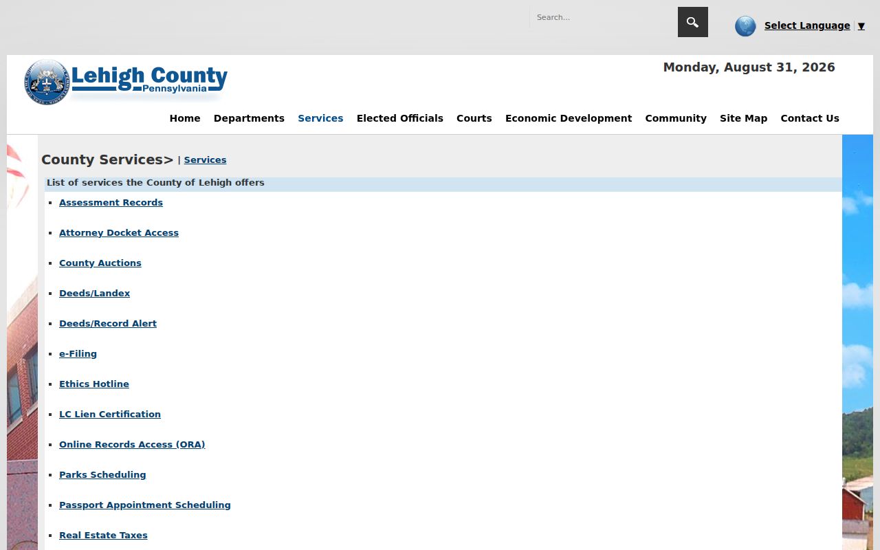
The county’s ORA FAQ describes a separate $300 annual subscription, normally activated within three business days and updated in 24 hours, for assessment, civil and current-tax material and historical Recorder/Will indexes. That account is not the same service as the free public property screen. The Recorder counter and local repositories remain meaningful fallbacks when a public search ends.
For a document that cannot be resolved from the public screen, use the Recorder counter or the documented subscription channel with the exact parcel and instrument details already collected. Books, computer images, and historical index references may require different retrieval steps because of the county’s 2002 image breakpoint.
Lehigh County Previous Residents Limits
A deed establishes a recorded transfer trail, while a directory, census, map, or obituary offers evidence from its own date and scope. The Morning Call obituary index covers 1895 through 1983, but its result supplies the appearance date and page, not the date of death. Retrieve the cited issue on microfilm before using the notice with a Recorder or Register of Wills trail. A probate index is likewise a lead to a clerk-held file, not proof of every family connection.
Lawful personal use. Use Lehigh County property-history and family-history records with care. Do not use a historical address trail to harass, track, expose, or contact a living person.
Where sources cannot support a link, preserve the conflict and stop. A historic-property guide, current property screen, or map label cannot replace the recorded historical index, the individual document, or a dated directory page.