
Search Lehigh County Streets
A street-by-street inquiry starts with the parcel, not a name list. Enter the complete site address, including any direction, suffix, unit, mailing label, and date being checked. The first return supplies a property lead. It cannot establish everyone who lives there. Preserve the county’s address wording before comparing it with older sources, because a street number or municipal label can change while a parcel trail continues.
- Run the normalized address in the County Property Search and retain the exact input, return date, PIN/PAR, and any document number.
- Open that identifier in the Parcel Viewer. Check the full site line, parcel geometry, municipality, and assessment context before treating a suggestion as a match.
- Use the returned parcel as current ownership context only. A mailing line or assessed-owner field does not prove that a person occupies the site.
- Follow an instrument number or deed reference to the Recorder of Deeds, then read the actual instrument for parties, date, legal description, and prior reference.
- Work backward through grantor and grantee references. Use a dated directory or election product only through its separate access rules and only for its stated period.
That sequence, address to PIN/PAR to GIS context to instrument to Recorder chain, keeps the Lehigh County street directory tied to records that can be checked again later.
Lehigh County Address Intake
The public County Property Search has one search-text box and a required search-type selector. Its three choices are Address, Parcel Identification (PIN), and Document ID/Instrument Number. The form requires a CAPTCHA and at least four characters. It also asks users to omit special characters and follow its listed directional and street-suffix abbreviations. A miss is a reason to check the entered address, not to switch to an unlisted name search.
| PropertySearch field | How it is used | Verified limit |
|---|---|---|
| Address | Enter the normalized site address with the County’s allowed direction and suffix forms. | Four-character minimum and CAPTCHA apply. |
| Parcel Identification (PIN) | Enter the parcel identifier, optionally with PAR as documented by the County. | It is a parcel bridge, not a household record. |
| Document ID/Instrument Number | Use a known recording identifier for a document follow-up. | It is not a public party-name browse. |
There is no owner-name selector and no ZIP selector on the inspected public screen. That is why the street directory workflow starts with a full address and then preserves the returned identifiers.
The input rules matter when an address fails. The County lists only E, N, NE, NW, S, SE, SW, and W for directions, and it publishes suffix forms such as AVE, BLVD, CIR, CT, DR, LN, PKWY, PL, RD, ST, TER, and WAY. Retain the original source wording in the research note, but try the County’s normalized form at the search box. If the result still does not fit, move to Assessment Address or PIN Search in the map viewer instead of stripping an address down to a bare street name.
The official Property Search screen shows the limited public form used for this address step.
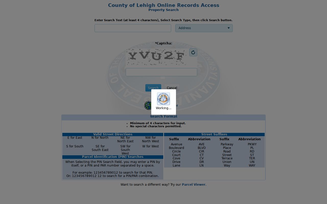
Its three-mode selector is a useful reminder that a County property query is narrower than a general street directory.
Lehigh County PIN and PAR
PIN and PAR are the durable identifiers behind an address-based search. The County’s PIN certification guidance says a PIN has 12 digits and a PARNUM has one to five digits. They may be separated by a space or dash, and leading PARNUM zeroes are permitted. Save both values as returned. An older map, block, or lot reference is a useful historic clue, but the County expressly says it does not replace PIN/PAR.
- PIN
- The County’s 12-digit parcel identification number, used to join a property result, map context, and Recorder work.
- PAR or PARNUM
- A one- to five-digit parcel-related number that may accompany the PIN in a County query.
- Situs address
- The physical site address attached to a parcel record, kept apart from correspondence lines.
- Instrument number
- The recording identifier that points to a specific Recorder document for closer reading.
Lehigh County Parcel Viewer
The Lehigh County Parcel Viewer adds map and assessment context after a property return. Its public configuration offers an address/place geocoder, PIN Search, and Assessment Address search. PIN and assessment-address results are not exact-only and are limited to six suggestions, so each candidate needs a full site-address and municipality check. Red centroids lead to assessment information, while More Info is the route for the current source.
The viewer also exposes parcel geometry, site-address components, sales and land-use context, plus separate assessment owner and mail fields. Those fields can help audit one parcel. They cannot turn a street search into a roster of present occupants. The County’s map disclaimer also says parcel lines are reference material, not proof for an engineering or boundary dispute. Keep a retrieval date with any map observation.
For a limited block check, the Viewer’s Buffer Report can begin from an Address or PIN result or a drawn feature. Its configuration has a 100-foot default and a maximum of 1,000 features. Treat that output as nearby parcel context: save the buffer distance, site lines, PINs, land-use or class fields, map disclaimer, and query date. Do not infer relationships, occupancy, or title boundaries from the nearby shapes.
Lehigh County Street Records
Each address-keyed source answers a narrow question. The following coverage is more reliable than treating one hit as a complete account of a street. It also keeps current ownership context, regulated election material, municipal records, and historical household evidence in their proper lanes.
| Address-keyed source | Lehigh County keeper | Street-level value | Access boundary |
|---|---|---|---|
| Property Search | County Online Records Access | Address, PIN, and document lead for a particular property | Free public form, CAPTCHA required |
| Parcel Viewer | County GIS | Parcel geometry, situs, assessment, and land-use context | Reference map, not boundary proof |
| Recorded instrument | Recorder of Deeds Division | Parties, date, legal description, and prior-record reference | Read the actual document through the appropriate channel |
| Street or walking list | Pennsylvania election authorities | Regulated election-list product arranged by residence information | Signed request and statutory conditions apply |
| City permit or code material | Allentown RTK Data Hub | Address-oriented municipal record lead, when applicable | Check the record ID and request underlying material if needed |
The parcel number connects the property screen, map, and Recorder path. A street name alone does not make those systems interchangeable.
Lehigh County Recorder Trail
The Recorder of Deeds Division is where an address-led parcel inquiry becomes a document trail. County material describes Recorder records from 1812 onward, the Russell Index for 1812 through 1983, and LANDEX/Russell-book access from 1812 to present for ORA subscribers. Capture the instrument number, recording date, document type, grantor, grantee, legal description, PIN/PARNUM when shown, and prior book or record reference from the image itself.
The retrieval medium changes with the date. County background says book records ran through April 19, 2002, and computer images began April 22, 2002. That transition does not prove an online image is available for every item. The Recorder counter remains a real access channel, and its published guidance says staff cannot perform the search or provide legal advice. A deed records a transfer or other instrument; it does not establish all people who lived at the site.
For a parcel that someone already has a legitimate reason to monitor, the County also offers a free Record Alert service. A verified recording can generate a text or email notice with the parcel number, instrument number, document type, and date. It is a prospective notification channel, not a title examination, identity tool, or retroactive history. The notice is best used to retain identifiers for a later Recorder check.
Lehigh County Record Access
The free Property Search and the County’s deeper Online Records Access subscription are different tools. The ORA FAQ describes a subscription covering assessment, civil and current-tax material, historical Recorder and Will indexes, IQS Infodex Russell 1812 to 1983, and LANDEX with Russell books from 1812 to present. It states an annual cost of $300, normal activation within three business days, and updates in 24 hours. Confirm current terms with the County before purchase.
The County’s ORA service landing page is the official starting point for deciding whether a public screen, subscription route, Recorder counter, or a narrowly described request fits the needed record.
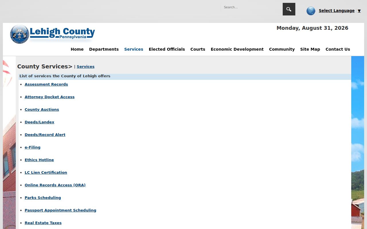
The separate service route helps prevent the common mistake of assuming that a free address form exposes every historical Recorder index.
Lehigh County Street Lists
Pennsylvania treats a street list and walking list as separate, regulated election products. The individual voter-status route is for checking a registrant’s own status, not open browsing of a street. The state’s voter-list request form separately offers Public Information, Street, Walking, and Full Voter Export list types, requires identification and a signed affirmation, and limits use and internet publication.
For a Lehigh County office channel, Voter Registration is at the Government Center and publishes telephone, email, and business-hour contact information. A street directory should record the list type, request date, and statutory condition rather than recast a regulated election product as a general address directory.
The governing rules are part of the record, not an afterthought. Election Code provisions distinguish supervised inspection and copies from broad republication, exclude protected identifiers such as the SURE number and digitized signature, and protect voter email addresses. An Address Confidentiality Program participant may use a substitute address. Record access therefore depends on the particular product, its request conditions, and the date, rather than on the existence of a street name.
Lehigh County Street Labels
A postal city can differ from the mapped municipality. County PIN-certification guidance specifically addresses a city or town mailing description that differs from the municipality and tells recorders to include the ZIP in that situation. Keep the site address, mailing city and ZIP, municipality, and PIN as separate notes. That is particularly useful before following a deed or City record, since an Allentown mailing label may not identify the municipal research route.
For a ZIP-first starting point, confirm the delivery address and then return to the normalized street and parcel process. The Lehigh County ZIP directory preserves the county layer’s postal cautions without treating a ZIP as a property-search filter.
Lehigh County Street Privacy
A Lehigh County street directory cannot prove who occupies every address, and it should not convert a separate assessment mailing line into a household finding. Pennsylvania’s Address Confidentiality Program can provide eligible participants an alternate address in listed government records. A substitute address, redaction, or missing result is a safety boundary, not an invitation to combine other records until a physical address is exposed.
Lawful use. Use address-led records for personal, lawful research such as property history or checking a custodian’s record. Never use them to stalk, harass, or harm anyone.
Lehigh County Address Corrections
When a parcel, assessment, Recorder-index, or court item appears wrong, keep the PIN, instrument number or docket number, source URL, screen capture, and retrieval date. Send a factual correction question to the division that maintains that specific record. The Pennsylvania Right-to-Know Law is an access process, not a universal correction or deletion tool. A sufficiently specific county request normally receives a response within five business days, subject to the law’s redactions and extensions.
Use the County’s standard Right-to-Know request form when an administrative record is not published online. State the record description, date range, delivery preference, and any fee limit. Do not reconstruct sealed or withheld information from a different source.
Lehigh County Record History
The street directory becomes more dependable when its dates stay visible. Recorder material begins with the County’s 1812 record history, while the analog-to-image break in April 2002 changes the likely retrieval route. A historic directory or map can preserve an earlier street wording, but it is evidence for that dated source only. Keep its original wording beside the current PIN and legal description, and mark any connection that still needs an instrument check as unverified.
Note: No official countywide street-renumbering or street-renaming crosswalk was located in the reviewed material, so a numeric conversion should never be guessed.